Fulfilling the promise
Yochai Eisenberg is making cities more accessible for people with disabilities


With his background in health policy, disability rights and urban planning—and an enthusiasm for collaboration with other researchers—Yochai Eisenberg works to create accessible cities for people with disabilities.
“I was interested in environmental design and how it affects people's behavior,” said Eisenberg, DHD assistant professor and researcher in the Great Lakes ADA Center, in explaining his career path.
“I saw how much difficulty people with disabilities have in public spaces, and the big gap in terms of training, research and application.”


He is co-investigator on five current federally funded research projects, based at UIC and two other universities, to provide resources for fulfilling the promise of the Americans with Disabilities Act.
“Our research, which focuses mostly on the pedestrian environment, has helped show that cities aren't making enough progress in becoming fully accessible for people with disabilities,” said Eisenberg, who was recently named to the U.S. Department of Transportation’s Advisory Committee on Transportation Equity.
Over 30 million people in the U.S.—including about 500,000 Chicago residents—have at least one physical disability that affects their ability to move around, and almost half of them rely on wheelchairs, canes, crutches and walkers. When they travel about their neighborhood, they are often impeded by obstructions, broken concrete, lack of curb cuts, no audible crossing signals and other barriers.
Since 1999, courts have consistently ruled that sidewalk accessibility is guaranteed by the ADA. This leaves cities with two choices, Eisenberg said: be forced into it by lawsuits (Chicago lost a case last year for failure to provide audible pedestrian signals) or create their own ADA transition plan.
For the latter, Eisenberg and the Great Lakes ADA offer resources and technical assistance.
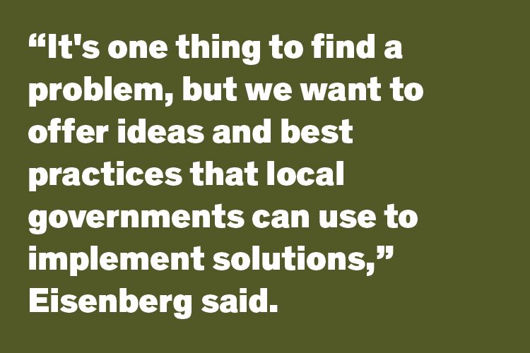
"It's one thing to find a problem, but we want to offer ideas and best practices that local governments can use to implement solutions," he said.

Before a city can develop a plan to improve accessibility, problems must be defined and located. How can a city survey thousands of miles of sidewalks?
Answer: Project Sidewalk, a collaboration with computer scientists at the University of Washington Makeability Labs and Easterseals.
Funded by the National Science Foundation, Project Sidewalk uses community scientists and artificial intelligence to locate, catalog and create interactive maps of barriers to pedestrian accessibility.
“We’re working with city governments and different community organizations—including disability organizations and urban planning groups—to be involved in this crowdsourcing approach to data collection and mapping of the accessibility of sidewalks,” Eisenberg said.
“It's both applied research and technology development.”
The mapping is done online with an easy-to-use interface. Mappers include community members and college students; researchers are recruiting high school students for a service learning program that teaches them about accessibility and disability justice and trains them to use the crowdsourcing tool.
The project is partnering with Easterseals to create a workforce development curriculum for recent high school graduates with disabilities, who will learn to be community scientists with Project Sidewalk while developing skills for leadership and advocacy.
So far, Project Sidewalk includes data on pedestrian right-of-way accessibility for 11 cities: seven in the U.S. (including Chicago), three in Mexico and one in the Netherlands.
Part of the grant is working with cities to use the data, Eisenberg said.
“We explain that Project Sidewalk is a free resource to jumpstart your planning, because you’ll have all this data about accessibility.”
Newberg, Oregon, population 25,000, is one of Project Sidewalk’s success stories. After all the streets were mapped, the town used the information to develop a pedestrian accessibility plan and fund improvements.
As a resource, the Great Lakes ADA Center created a casebook of cities that have successfully implemented public accessibility projects, including suburban Naperville, Tempe, Arizona, and Bend, Oregon.
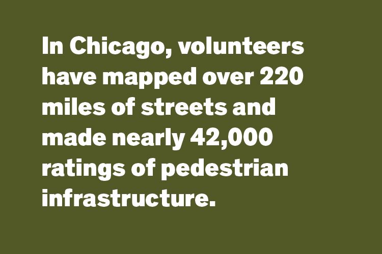
In Chicago, volunteers have mapped over 220 miles of streets and made nearly 42,000 ratings of pedestrian infrastructure.
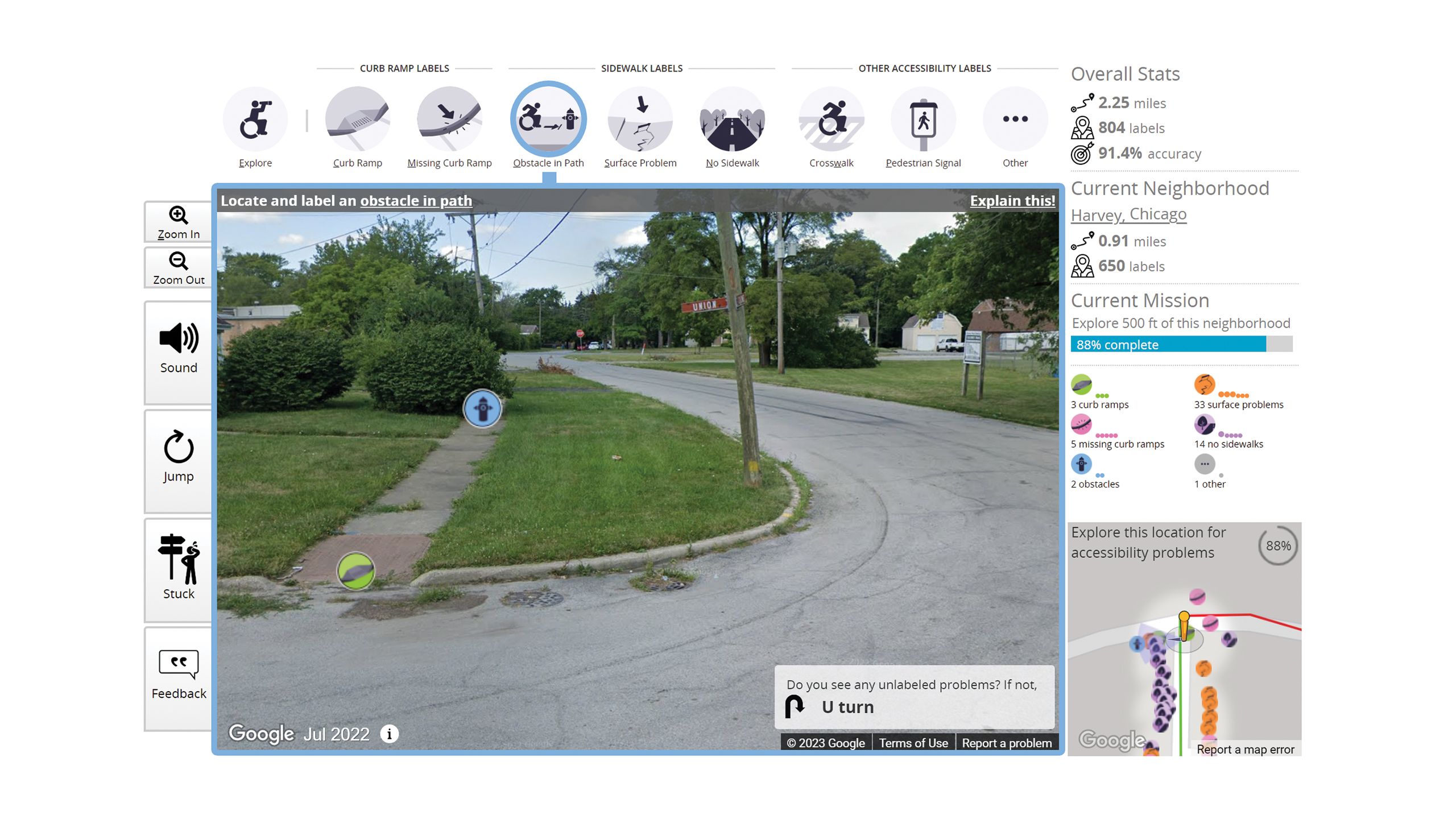
A screenshot of the Project Sidewalk virtual interface shows a Google Street View image of a sidewalk and corner in Harvey, Ilinois. The user placed labels to indicate a curb ramp and an obstacle on the sidewalk. The interface shows the user's stats in a panel on the right side and a graphic overview in the bottom right corner.


Eisenberg’s team is working with aldermanic offices in Chicago’s 40th and 3rd wards to define the accessibility needs in those neighborhoods, which are interested in using a participatory budgeting process for accessibility improvements.
Working with the disability rights group Access Living, student volunteers from Eisenberg’s Disability, Urban Planning, and Geography course used Project Sidewalk to map barriers to accessibility around five Chicago transit stations.
Eisenberg is involved in a long list of other projects to develop tools and resources for improving accessibility.
With researchers at the University of Alabama Birmingham and the Centers for Disease Control and Prevention, he developed the Community Health Inclusion Index, which assesses barriers to physical activity and healthy eating. The tool is available online from the National Center on Health, Physical Activity and Disability.
“It's used by different communities to collect information about how inclusive their policies, systems and environments are, focused on aspects of health promotion within their communities,” said Eisenberg, who offers training to use the tool.
For example, in Worcester, Massachusetts, “they used the CHII assessment in every playground in the city, then used the results to prioritize grant funds for making certain playgrounds more inclusive,” he said.
Eisenberg is co-principal investigator on “We Walk 4 Health” with Kelly Hsieh, DHD research associate professor. Working with community-based organizations, the project uses mobile phones and fitness trackers to encourage physical activity and wellness for adults with intellectual and developmental disabilities.
He’s co-investigator for “Everybody Moves!”, a project led by Delphine Labbé, DHD assistant professor, to promote leisure-time physical activity for Latine and Black people with disability.
He’s also co-investigator for ADA PARC, a UIC-based national resource center led by Joy Hammel, OT, DHD and RS professor, that gathers and analyzes data about participation disparities for use in advocacy.
Other projects have included developing an algorithm to identify adults with mobility limitations, found through health care administrative data, and an analysis of the use of ride-share by people with disabilities.
In “Mapping Disability Experiences During the Covid-19 Pandemic,” he and fellow researchers invited people with disability to share submissions that illustrated how the pandemic affected their lives.
Besides his recent appointment to the Department of Transportation advisory committee, Eisenberg has been a member of advisory groups on accessibility for the Cook County Forest Preserve, the Centers for Disease Control and Prevention, the CTA and the American Public Health Association, among others.
He discusses accessibility issues in presentations to ADA coordinators, mayors and metropolitan planning organizations, and to the public in news interviews, including NPR.
“I really do enjoy collaborations with different people across disciplines,” he said. “It’s so mutually beneficial when you find good collaborators.”